Vehicle completes five autonomous runs at underground mine – without GPS, fixed infrastructure, maps
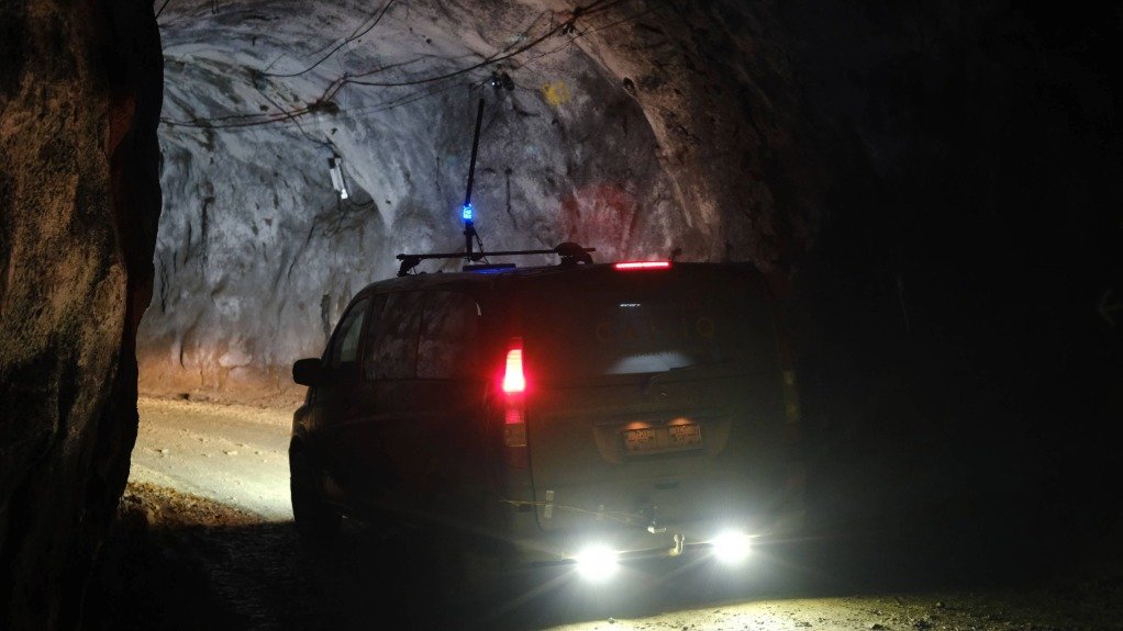
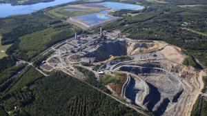
Advanced Navigation's autonomous vehicle traveling down the Pyhäsalmi Mine in Finland
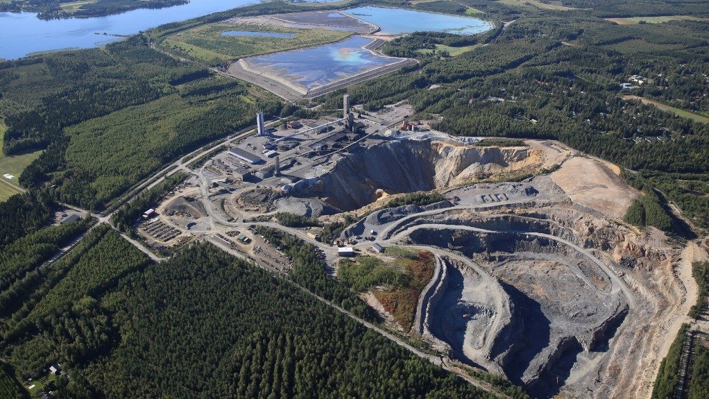
The Pyhäsalmi Mine
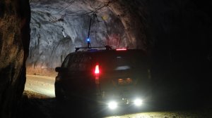


Navigation and autonomous systems company Advanced Navigation has sent an unmanned vehicle down Europe’s deepest underground mine (1.4 km) in Finland, and back up again, doing so without GPS, fixed infrastructure or maps.
The vehicle operated between 400 m and 1.4 km depth, across 22 km of tunnel.
It maintained a position error of less than 0.1% of distance travelled and, in some cases, exceeded GPS-level accuracy.
Advanced Navigation says this is the equivalent of navigating through a pitch-black tunnel across ten soccer fields and arriving within a single step of the target.
Selected from more than 90 global applicants, a demonstration of the new Hybrid Navigation System was livestreamed from the base-metal Pyhäsalmi mine as part of the Deep Mining Open Call under mining group BHP’s Think and Act Differently programme.
Advanced Navigation says its new Hybrid Navigation System entered a completely new environment and returned with precise positioning data, “proving that the future of fully autonomous mining is within reach”.
The system, combining a laser velocity sensor (LVS) with the Boreas D90 fibre-optic gyroscope (FOG) Inertial Navigation System (INS), could repeat this accuracy across five separate runs, without relying on any fixed positioning infrastructure, pre-existing maps or external aiding.
“Unreliable navigation underground isn’t a minor technical constraint – it’s a major operational bottleneck,” says Advanced Navigation senior product manager Joe Vandecar.
“Maintaining precision over a 22.9 km subterranean course in Europe’s deepest underground mine demonstrates a level of performance that few systems in the world can rival without any prior intelligence of the environment.
“These results prove we are one step closer to unlocking scalable underground autonomy.”
Navigating the subterranean network of the Pyhäsalmi mine poses significant challenges.
Located 1.4 km underground with a 63 degree latitude, just two degrees below the Arctic Circle, the mine is completely impervious to global navigation satellite system (GNSS) signals.
Its repetitive, multi-level tunnel network creates a high risk of visual disorientation, while its metallic ores distort magnetic fields and scatter radio waves.
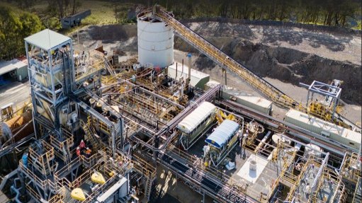
To overcome these conditions, mines typically rely on infrastructure-heavy solutions such as ultra-wideband beacons, Wi-Fi, 5G repeaters, or perception-based techniques such as simultaneous localisation and mapping, which require cameras.
According to Advanced Navigation, these methods are costly to integrate and maintain, slow to install, and often unavailable in hazardous or unmapped zones where reliable navigation is critical.
Cue inertial-centred architecture.
Advanced Navigation’s new Hybrid Navigation System is centred on Boreas – a FOG INS.
Unlike more conventional systems, Boreas does not rely on GNSS or magnetic compasses.
Instead, it uses ultra-sensitive FOG technology to detect the Earth’s rotation and determine true north, a process known as gyro-compassing to find the vehicle's direction (heading).
To maintain and enhance this accuracy, the INS is fused with Advanced Navigation’s LVS.
Using infrared lasers, LVS continuously measures the vehicle's true 3D velocity relative to the ground.
This real-time data is critical for correcting the gradual drift that occurs in standalone inertial systems, enabling the hybrid system to maintain precision over extended distances.
This integration is made possible with Advanced Navigation’s AdNav OS Fusion software.
Using adaptive algorithms, it dynamically weighs the reliability of each sensor in real time.
Together, these technologies form a hybrid system delivering what Advanced Navigation describes as “precise, uninterrupted navigational data in extreme environments”, without the use GNSS or fixed infrastructure.
While mines are expected to continue to use fixed infrastructure, this technology significantly reduces dependency, enabling resilient, high-precision navigation in previously inaccessible or unmapped areas, notes the company.
The group adds that the technology unlocks scalable autonomy with real-time tracking, optimised haulage, predictive collision avoidance, material tracking, efficient ore extraction and tele-remote operations.
“Ultimately, this vehicle-based, inertial-centred architecture provides the resilient foundation required for the mining sector to achieve its long-term goal: efficient, autonomous ore extraction at depths hostile to human activity,” notes Vandecar.
The Hybrid Navigation System is set for commercial release later this year.
Comments


Projects
Latest Multimedia


Latest News
Showroom
As one of South Africa's leading manufacturers, Bell Equipment distributes and exports its wide range of heavy equipment globally to mining,...
VISIT SHOWROOM
John Thompson, the leader in energy and environmental solutions through value engineering and innovation, provides the following: design, engineer,...
VISIT SHOWROOM


Press Office
Announcements
What's On
Subscribe to improve your user experience...
Option 1 (equivalent of R125 a month):
Receive a weekly copy of Creamer Media's Engineering News & Mining Weekly magazine
(print copy for those in South Africa and e-magazine for those outside of South Africa)
Receive daily email newsletters
Access to full search results
Access archive of magazine back copies
Access to Projects in Progress
Access to ONE Research Report of your choice in PDF format
Option 2 (equivalent of R375 a month):
All benefits from Option 1
PLUS
Access to Creamer Media's Research Channel Africa for ALL Research Reports, in PDF format, on various industrial and mining sectors
including Electricity; Water; Energy Transition; Hydrogen; Roads, Rail and Ports; Coal; Gold; Platinum; Battery Metals; etc.
Already a subscriber?
Forgotten your password?
Receive weekly copy of Creamer Media's Engineering News & Mining Weekly magazine (print copy for those in South Africa and e-magazine for those outside of South Africa)
➕
Recieve daily email newsletters
➕
Access to full search results
➕
Access archive of magazine back copies
➕
Access to Projects in Progress
➕
Access to ONE Research Report of your choice in PDF format
RESEARCH CHANNEL AFRICA
R4500 (equivalent of R375 a month)
SUBSCRIBEAll benefits from Option 1
➕
Access to Creamer Media's Research Channel Africa for ALL Research Reports on various industrial and mining sectors, in PDF format, including on:
Electricity
➕
Water
➕
Energy Transition
➕
Hydrogen
➕
Roads, Rail and Ports
➕
Coal
➕
Gold
➕
Platinum
➕
Battery Metals
➕
etc.
Receive all benefits from Option 1 or Option 2 delivered to numerous people at your company
➕
Multiple User names and Passwords for simultaneous log-ins
➕
Intranet integration access to all in your organisation